

ZüriPlan app for iPhone and iPad
Developer: Stadt Zürich, Amt für Städtebau
First release : 23 May 2011
App size: 564 Kb
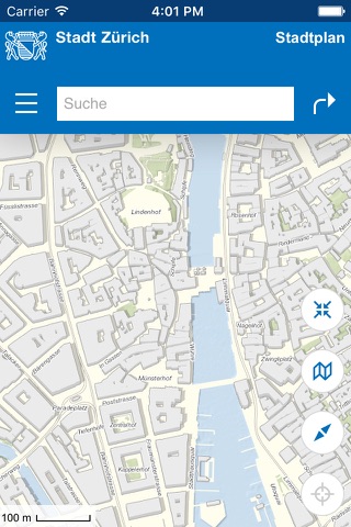
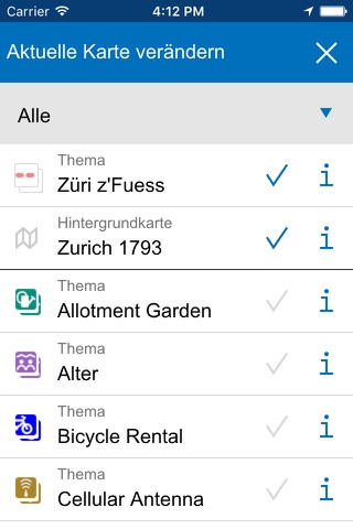
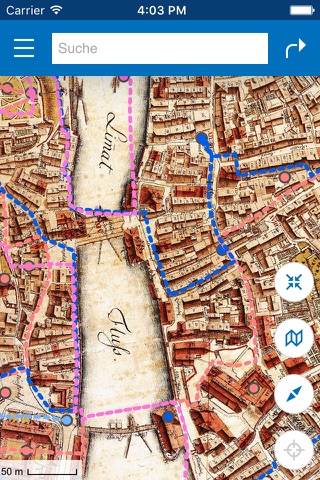
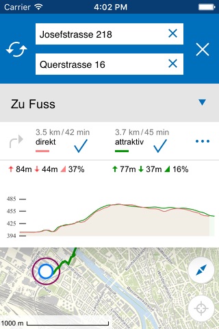
The official ZüriPlan App provides an interactive map of the city of Zurich for iPhone and iPad devices. Since summer 2016, the map of Zurich is also available as browser version at https://www.stadt-zuerich.ch/stadtplan. The App as well as the browser version allow you to search and view different themes (e.g. sport facilities, playgrounds, stops of public transport system, construction sites). Additionally, a route planner for bikers and pedestrians is integrated which allows to fetch attractive and/or short routes inside of Zurich. Furthermore, many interactive Züri zFuess tours can be discovered with interesting facts and figures about the history of Zurichs quarters.
Functionalities:
+ Map with aerial image, city map and historical maps
+ View and search of addresses and points of interest
+ GPS and compass support
+ route planner for pedestrians and bikers
+ 20 Züri zFuess tours
+ offline usage
+ drawing and measuring
+ sharing of maps
+ import of WMS links as well as KMZ files
Latest reviews of ZüriPlan app for iPhone and iPad
Got this for the walking tour maps. Running on iOS 6 on iPhone 4S it opens and says loading then crashes immediately. A shame since I think this app has great content based on the maps on the corresponding website.
Very disappointed with this app, which I downloaded before a recent trip to Zurich. It provides a low-res city plan, one not as clear even as whats on Apple Maps. On this map there is quite a bit of extraneous unlabeled information that makes it difficult to read. The app is also slow and clunky, and scrolling through the city causes information to vanish forever and randomly. The app overlays the citys public transportation system onto the map, but will not incorporate the streetcars into any inquiries about how to get somewhere. So you can find out how to walk six kilometers from one place to another, but not how to get there with public transportation, which I venture to say most of us would prefer! Especially in a Swiss winter. It absolutely failed to help me answer a simple question: how to get from the nearest streetcar stop to the airport. This is the kind of question that virtually every visitor or new resident will need to know. After ten minutes of fiddling with the app, I finally gave up and asked the desk clerk in my hotel, who drew it for me onto a printed map. So much for the paperless future. Needs work, Im afraid.